The remote north west of Namibia
From Windhoek to Swakopmund, taking a detour via Kaokoland
After a few years of living in Namibia, my family decided to move to Cape Town seeking out greener pastures. But I continued having the opportunity to visit Namibia every so often, doing what I love most – exploring this country. As life often is, choices led to limiting these visits later, but I knew the day would come when I would get out there and experience it all again. Keeping the memories locked up tight in my brain, it gave me something to look forward to.
Recently I was visited by a long-lost friend, who came to visit me in Windhoek. Over a wine and stuffed ciabatta sitting at a fire, we reminisced about what we had missed over the past 7 years since we last saw each other. She wanted to know whether I was still regularly travelling within Namibia. ”It is part of what you are”, she observed and it was then, that I realised the time was right, to go back to my roots. There, where the sun is harsh, the landscapes vast, the animals free and the people real. I wanted to sit at a camp fire and forget about everyday reality for a while.
“Actually,” I answered, “I might be going to Kaokoland.” She grabbed a leather bag which I bought in Spain a few years back, and placed it next to me on the floor with my camera: “You’re going.” I suddenly had a sensation of the cool breeze of Epupa blowing on my cheeks, tasted the dust of the Hoanib and heard the trumpet of a desert elephant calling for the herd: “I’m in, I’m going.”
I returned after 10 years to visit all of the places that helped shape who I am today. And boy did it blow off my socks once again. Kaokoland still remains one of the more revered and scarcely visited areas of the country, and for some its existence might be a mere matter of fact, but to me it is reality - what I refer to as home.
DAY 1
Ready, steady, go
The first day of my ten-day trip through Kaokoland, I spent on the long road from Windhoek to Khowarib Lodge, where my itinerary was set to start. The road up to Khowarib led me through Kamanjab and the well-known Grootberg Pass and Palmwag Lodge, where I filled up the vehicle. The conditions of the gravel roads on that last stretch for the most part are good, but you need to remain cautious. I arrived at Khowarib just in time to take a seat at the dinner table underneath the stars, sipping my way through a G&T, as my guide for the following few days, Caesar Zandberg, owner of Khowarib Lodge and Kunene Tours and Safaris, gave me a short, but very informative introduction about what I could expect during the planned itinerary. With huge excitement, I spent the night in a tented chalet on the bank of the Hoanib river, dreaming about all the places that had been hiding somewhere in my memory.
DAY 2
Giribes Plains
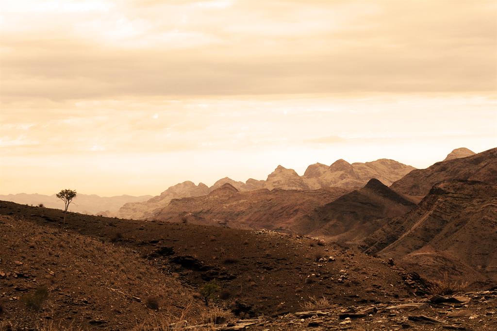
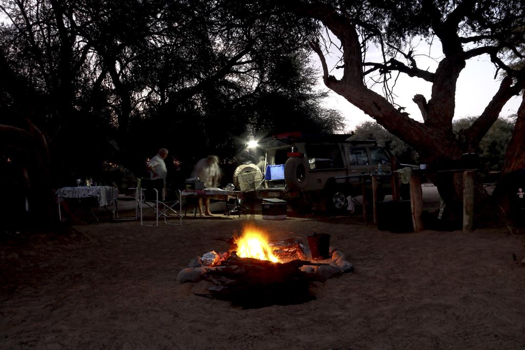
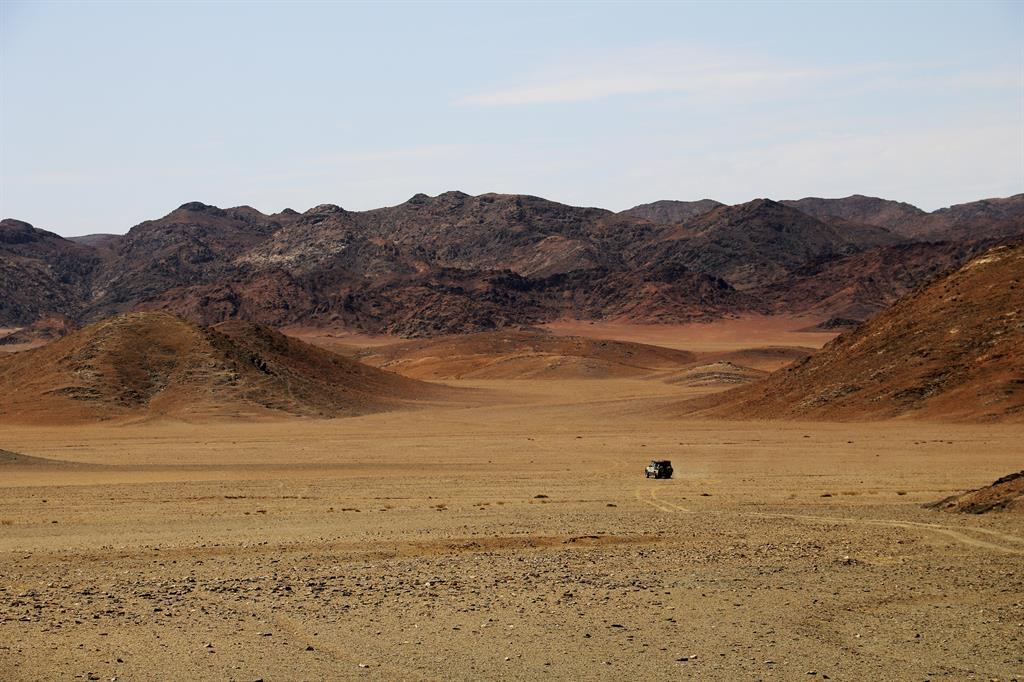
We depart from Khowarib Lodge, in the early morning hours and drive via Sesfontein to Warmquelle and on to the Giribes Plains on our way to Purros. The Girrebez Plain is situated about 30km north-west of Sesfontein and has some of the most beautiful landscapes I have witnessed. We travel further west entering the upper Obias River and on to the Okongwe Spring, where we enjoy a freshly prepared lunch. The Okongwe Spring is a popular location among large amounts of animals because of its water. After lunch we head north for a further 30km toward Purros, arriving there just before twilight. At Purros the visitor can choose among various campsites and the Okahirongo Elephant Lodge - we choose the Omenje campsite. A traditionally prepared “staanrib” (rack of lamb), stuffed butternut, braai rolls with a fresh salad is on the menu this evening, our first night in the wild – pure bliss. Purros is something special in the sense that there is a tranquil peace in this absolute state of “nothingness”. Simply sitting under a huge tree and sipping some ice cold water while listening to- and in harmony with nature makes me content. Moving beyond my routine, yet it is still so familiar.
DAY 3
Ovahimba and the Hoaruseb
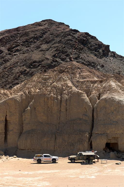
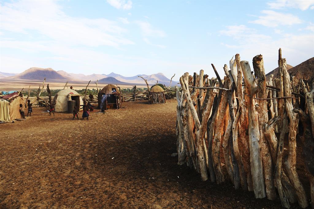
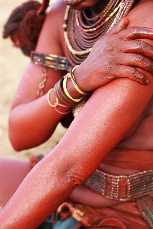
I wake up to the smell of freshly brewed coffee as well as bacon and eggs sizzling on the remaining heat of last night’s embers, while Caesar is packing the vehicle for a day’s excursion to Purros and its surrounding area. After enjoying a warm breakfast, we head out to a local Himba village, where we spend two to three hours being mesmerized by their ancient lifestyle. During our visit we receive various demonstrations as to how the Ovahimba survive in these harsh conditions. After that we return to base camp in order to collect fresh produce required to prepare a light lunch. We travel down the Hoaruseb River at the edge of the Skeleton Coast and are ultimately treated once again to a restaurant-type quality meal. Later in the afternoon we visit the Clay Castles. Our day ends by driving a detour towards the north via the Khumib River and back to the Omenje campsite.
DAY 4
Hoanib heaven
During this time of the year the sighting of wildlife during the early morning is incredible. Animals and birds tend to be more active during the early morning and late into the night, as the temperatures are excruciating through the day. We start the day by sighting antelope and various other desert adapted animals. This day is spent travelling from Purros via the Ganjas Plains into the Lower Hoanib River, a journey of approximately 70km. The terrain is rather harsh, so although 70km does not sound like a tall order, it will take you not less than three hours and up to four hours to pass through the lower Hoanib. The Hoanib River is home to the extraordinary Desert-Adapted Elephant. All wildlife is roaming free in this region – there are no fences. A delicious lunch in the shade of a big Mopani tree helps us escape the deadly sun which pummels the dry riverbed and sends the temperature up to 42°Celsius. We resume our journey, which leads back to Sesfontein passing the famous Dubes Poort, and newly completed Hoanib Valley Camp. In Sesfontein we fill up the vehicles for the trip up north, to Opuwo. Upon our arrival in Opuwo we check into the Opuwo Country Hotel, which allows for a pleasant and comfortable stay. Watching the sun set from the Opuwo Country Hotel is a sight quite apart.
DAY 5
The Natural North
Opuwo wakes to a welcome downpour. Although certainly not enough, any amount of rain is welcomed in Namibia. We buy fresh produce and refill our vehicles. If you are lucky, some of the locals in Okongwati further north might have some fuel to sell, but it is better not to push your luck. It is safer to fill up in Opuwo and buy all your necessary goodies. During my time in Opuwo, I pay a shot visit to the Community Skills Development Centre (COSDEC), where after we head out towards and passing Onkongwati, in order to reach my ultimate goal, the Epupa Falls.
Onkongwati being a very small settlement only has the bare minimum to offer. It is a perfect spot to stretch your legs and take some photographs of the surrounding landscapes. The local inhabitants make a small “gwenya” (similar to Vetkoek) that works well with leftover braai meat. We indulge in a few of these and travel the last 80 km to Epupa, reaching Omarunga Lodge, where we stay for night. The area has ample to offer. Walking and exploring the area around the waterfall, visiting Ovahimba villages and having a beer with local folk just to mention a few. Omarunga Lodge is situated about 200m upstream from the Epupa Falls and it’s strikingly, beautiful setting next to the river is impossible to put in words. It is simply stunning. Even though Omarunga has a lodging option, we prefer to camp, thus shrinking the distance between our camp and the river to a mere three meters. Here I finally experienced what I had been longing for over many years. Apart from going for a swim in the Kunene - which is not advisable - you cannot get any closer to the mighty Kunene River.
DAY 6
Photo paradise
On the morning of day 6, I wake up with an excitement that is hard to contain. One of the specific places I remember visiting as a youngster, was Kunene River Lodge, but more so, the road along the banks of the at times meandering Kunene River. It was one of the reasons why I decided to take on this trip. I want to see what has happened in the past years and how humans have impacted on this iconic landscape. The first striking difference is the fact that a journey lasting between six and eight hours, taking a lot sweat, blood and tears – quite apart from wear and tear on your vehicle and tires – now almost reminds you of a highway, albeit a gravel road. Gone are the days when it demanded a full day as part of your itinerary.
The landscape and the natural habitat have been largely left untouched and the area is rather dry, but it remains exquisite. For any photo enthusiast this is where you obtain the “money shots”’. On my way to Kunene River Lodge, I stop at Swartbooisdrif which is mostly known as the place, where the Dorslandtrekkers passed through. Not far from this site you will find a memorial dedicated to these staunch Boers, who trekked all the way from South Africa through the Kalahari in order to settle in southern Angola.
With the area receiving some rain just before our journey, the road is wet, but nothing so extreme that the area becomes inaccessible. We arrive at Kunene River Lodge late in the afternoon, just in time to enjoy an ice cold beer. It is perfect timing to visit the fantastic deck stretching out over the river in front of the main restaurant area. We enjoy a home cooked meal and watch the sun become one with the river. Remember to apply mosquito repellent before you hit the sack, otherwise the mosquitoes will keep you busy.
DAY 7
The long Stretch
On the seventh day I follow the river from Kunene River Lodge to Ruacana, before I turn south to Hobatere Lodge, which is my next destination. Ruacana lies approximately 40 km upstream (east) of Kunene River Lodge displaying a similar landscape to that of yesterday.
I depart for Hobatere after breakfast and arrive in Ruacana by midday. I fill up fuel and buy some refreshments before turning south, towards the Galton Gate (the western entrance to Etosha). On the way I pass through Werda-Heck, which is the control point where the Northern veterinary fence, traverses Kaokoland. Eventually reaching the turn off for Hobatere Lodge, we travel around 16km into the concession area, which promises a great opportunity to spot lions, elephant and giraffe. The lions have made their way back to the north when I arrive, but lodge management still spotted them yesterday. The Lodge itself may be simple, but it is a favoured destination. Friendly staff and management aim at ensuring that your visit is as pleasant as possible. With the main area situated opposite a close-by waterhole, I enjoy a succulent steak while watching game approaching the water with the sun setting, almost simulating a postcard picture taken somewhere in the Serengeti.
DAY 8
Back to Khowarib
On day 8, I return to Khowarib Lodge. There are various routes available to choose from - some posing extreme challenges while others stick to the beaten track. The Hoanib River ran throughout the night forcing me to change my plans, which was to travel via Kamdescha to Baadjie and through the Khowarib Gorge and thus entering Khowarib from the east. As the last part of this route takes you through the Hoanib’s riverbed which was soaking wet, the possibility of getting seriously stuck at this time of the year is simply too big. I head back to the C43 form Hobatere and travel via Kamanjab back to Khowarib, taking the same route as on day 1. However this is no problem, as I – and probably most - thoroughly enjoy the view from the Grootberg pass while a lunch stop at Palmwag is always a great idea.
DAY 9
Along the Skeleton Coast
When leaving Khowarib for Swakopmund most people take the route through Damaraland past Uis, but I find the most appealing trip leads through Skeleton Coast National Park. Although the entire coastline of Namibia was formerly called The Skeleton Coast, these days it more commonly refers only to the Skeleton Coast National Park, which stretches from the Kunene River in the north over approximately 500km down to the Ugab River in the south. About one-third of Namibia's coastline remains under protection in this manner. The Skeleton Coast is famously associated with shipwrecks, and stories abound of sailors walking for hundreds of kilometres through this barren Namibian landscape in search for food and water.
I travel along the coast of Namibia down to Henties Bay, stopping at Fishy Corner for some fresh kabeljou, before I tackle the last 70km to Swakopmund. It gives me the opportunity to reflect on the past days and the wonderful experiences. As I arrive in Swakopmund, the coastal town is covered in a thick mist blanket, once again reminding me of all the different facets this country has to offer. They need to be written about – and I am ready.



Kommentar
Allgemeine Zeitung
Zu diesem Artikel wurden keine Kommentare hinterlassen